by Rachel Brown
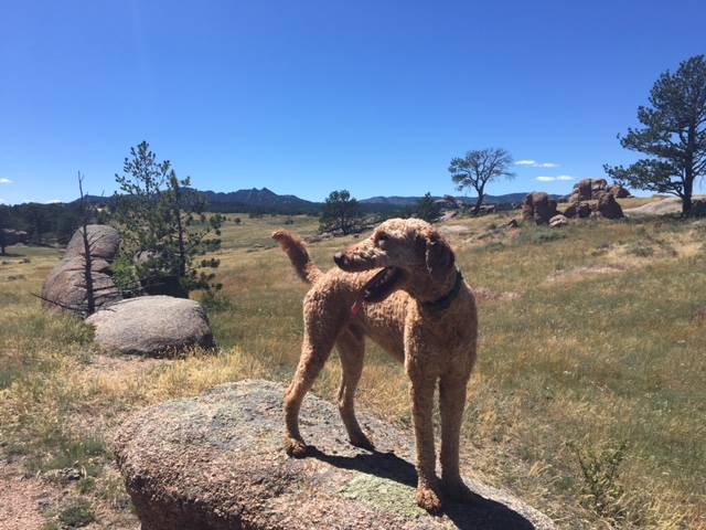
(Photo by Chris Hauser)
On August 1, we launched our #dogsoftheCDT photo contest. From now until August 25, 2018, we encourage you join us in celebrating the 40th anniversary of the CDT by submitting photos of your pup on the Trail! Four people will win prize packs including awesome gear like Altra running shoes, Zuke’s Natural Dog Treats, and an ENO CDT Doublenest hammock, while the grand prize winner will win a Wyoming getaway for two people and one pup!
Summer in Wyoming means beautiful sunny days and field full of wildflowers. What could be better? Enjoying the outdoors with your favorite hiking buddy, of course! To launch our #dogsoftheCDT photo contest, we’ve put together a list of a few of our favorite dog-friendly day hikes on the CDT in Wyoming. Grab your pack and your pup’s leash and hit the trail together at one of these awesome spots!
Bridger Peak
This 8-mile round-trip hike takes you to the summit of Bridger Peak, the highest peak on the Wyoming side of the Sierra Madre range. The summit is above timberline and has expansive views all around.
Getting There: Take Hwy WY-70 up to Battle Pass, west of Encampment. There is a parking area on the south side of the pass. Cross the road to the CDT on the north side of the pass and continue your hike from there.
Dog Safety: The CDT follows 4WD roads to the summit of Bridger Peak. Watch for vehicles on the route. The summit of Bridger Peak is above timberline, so keep an eye on the weather!
Huston Park Wilderness
The Huston Park Wilderness is quiet and perfect if you’re looking for solitude. The CDT runs through this Wilderness for about 45 miles, so you can make an out-and-back hike of any length! Head south from Battle Pass and follow the CDT as it skirts the side of Red Mountain and crosses the North Fork of the Encampment River. You’ll hit the Huston Park Wilderness boundary after a mile.
Getting There: Take Hwy 70 up to Battle Pass. There is a parking area on the south side of the pass. Head south from the parking area. The CDT through this Wilderness area is mainly marked with cairns and blazed trees.
Dog Safety: This hike enters a Wilderness area. Please obey all posted regulations. This is a popular area for elk hunting, so if you’re heading out during hunting season, keep your dog on a leash.
Green River Lakes
There are lots of opportunities for hikes of all lengths near Green River Lakes. Head north from the Green River Lake campground on the CDT to pass by some old homesteads. Want the best views by the lakes? Hike south on the CDT (called the Highline Trail in this area) as it traverses the western edge of the northern lake. After approximately 2.4 miles, turn off the CDT onto the Clear Creek Trail. Follow this trail for about a mile, past Clear Creek Falls, until you climb up onto a knoll. The view up Clear Creek valley is spectacular and well worth the 6.8 mile round trip!
Getting There: From Pinedale, take US-191 N, then follow WY-352 W for 25 miles. Continue onto Green River Lakes Road/Forest Road 650 until you reach the campground and trailhead.
Dog Safety: This hike is in grizzly territory! Keep your dog on a leash. This hike enters a wilderness area; please obey all posted regulations.
Union Pass/Lake of the Woods
Union Pass is a gentle, open pass with excellent views of the Wind River, Absaroka, and Gros Ventre mountain ranges. Nearby Lake of the Woods is a great spot for fishing or paddling. The CDT follows the south and west shores of Lake of the Woods. For a short hike, circumnavigate the lake. Or if you want a longer hike to tire out your pup, head south on the CDT towards Fish Creek Park.
Getting There: From Dubois, take Hwy 26/287 North. Turn left onto Union Pass Road. Follow Union Pass Rd. for approximately 13 miles, and then turn left onto Lake of the Woods Road. Lake of the Woods is about 2 miles ahead. Your vehicle should have good clearance, and AWD or 4WD are recommended, as the road to Lake of the Woods is rough.
Dog Safety: This is grizzly bear habitat! Keep your pup on a leash for their safety.
These are just a few of our favorite places to explore in beautiful Wyoming. Hit the trails, and don’t forget to submit your #dogsoftheCDT photo(s) by August 25 for a chance to win a trip to Wyoming with your canine companion!
Rachel Brown is CDTC’s Membership & Trail Information Specialist and objectively the most dog-loving person we’ve ever met.

