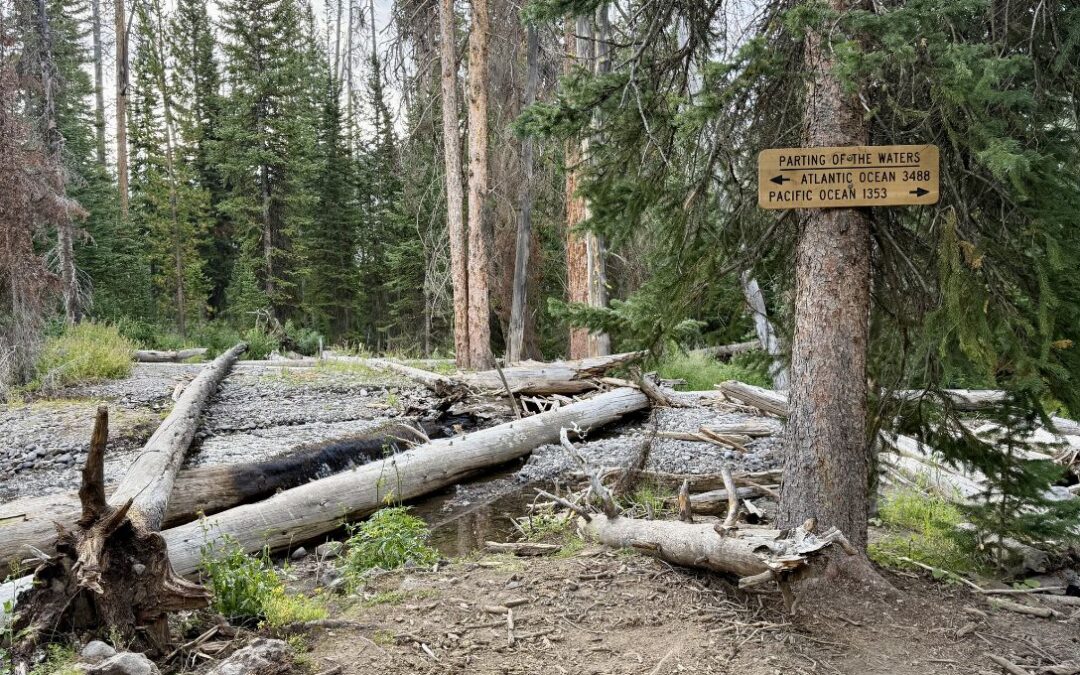
There’s a wooden sign in Wyoming’s Teton Wilderness that reads: “PARTING OF THE WATERS; ATLANTIC OCEAN 3488” with an arrow pointing left, and “PACIFIC OCEAN 1353” with an arrow pointing right. To a passing hiker, the spot looks like any other: a wooded area, a small stream. But this is one of the most remarkable hydrological features in North America.
Here, Two Ocean Creek splits cleanly in two. One branch begins a journey of more than 3,000 miles toward the Atlantic. The other flows over 1,000 miles toward the Pacific.
Stand at that fork and you’re standing on the Continental Divide itself: the invisible line that determines where every drop of water on this continent will end up.

It’s the kind of place that makes you start asking questions…
Why does the Divide run here and not somewhere else?
What forces shaped the mountains, ridges, and passes that define it?
And how old are those forces, exactly?
Those are the questions that Dr. Kevin M. Ward set out to answer. A field geologist, observational seismologist, and Continental Divide Trail thru-hiker (trail name: “Dr. Pepper”), Dr. Ward spent his career studying the deep-Earth processes that built the landscapes CDT hikers walk through every day. We’re thrilled to share his work in a new resource: Parting of the Waters: A Geologic History of the Continental Divide — an interactive storymap that connects the scenery along the CDT to the millions of years of geology beneath it.
The storymap covers everything from plate tectonics fundamentals to the specific forces that carved each mountain range along the trail. It’s a living resource we plan to expand over time. Here’s a taste of what you’ll find inside.
Yellowstone: A Living Hotspot
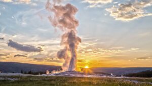
Most people know Yellowstone for its geysers. Fewer realize the entire park sits on top of one of Earth's most powerful hotspots — a plume of superheated rock rising from deep within the planet. Three massive eruptions over the last 2.1 million years shaped the landscape CDT hikers cross today, and beneath the trail lies a reservoir of still-cooling magma just kilometers below the surface.
The steaming ground and geyser basins along the CDT aren't just spectacles — they're evidence of one of the youngest and most active volcanic systems on the continent.
Wind River Range: 2.5 Billion Years Underfoot
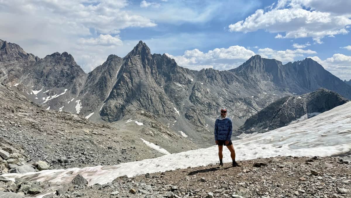
Many CDT hikers call the Wind Rivers the most spectacular section of the entire trail. The geology backs that up. Between 70 and 50 million years ago, immense compressional forces shoved enormous blocks of ancient rock upward along reverse faults, lifting granites and gneisses that are 2.5 billion years old into the high peaks around Titcomb Basin and Knapsack Col.
Glaciers later carved cirques and chains of alpine lakes into those uplifted blocks. When you're hiking through the Winds, you're walking on some of the oldest exposed rock in North America.
San Juan Mountains: One of Earth's Largest Eruptions
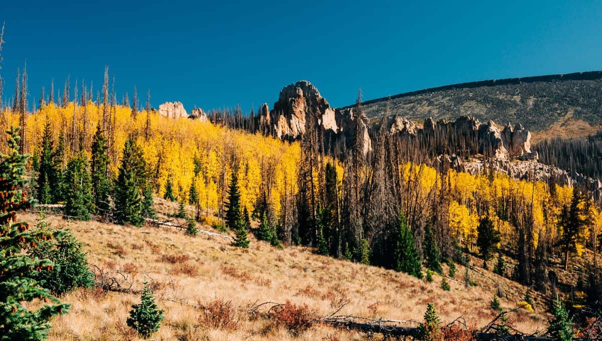
Between 35 and 23 million years ago, massive eruptions laid down thick layers of ash and lava across southern Colorado. The La Garita Caldera produced the Fish Canyon Tuff — one of the largest known eruptions in Earth's history, thousands of times more powerful than the 1980 eruption of Mount St. Helens.
Later on, huge glaciers carved steep ridges and deep basins into the volcanic rock. CDT hikers crossing the San Juans are traversing a highland built from ancient catastrophe and sculpted by ice.
El Malpais: Where the Earth Is Still Creating
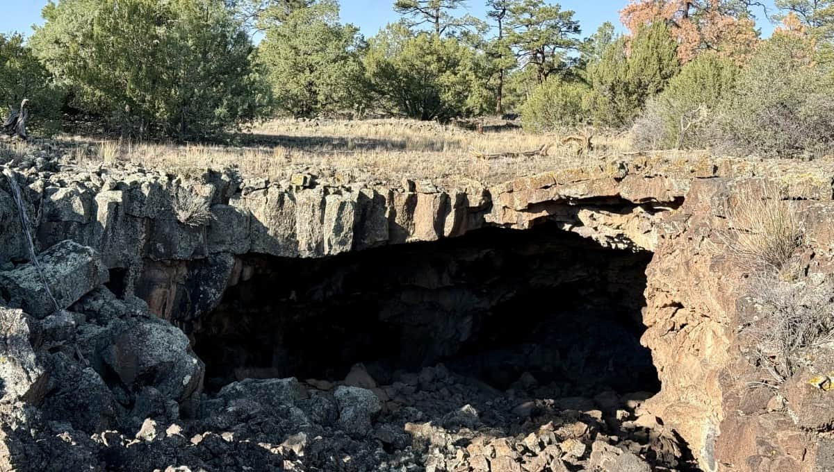
Near the southern end of the CDT, El Malpais National Monument holds some of the youngest volcanic features on the entire trail — basalt flows erupted within the last 3,000 years, a blink in geologic time.
The dark rock preserves lava tubes large enough to walk through today, formed when the surface of flowing lava hardened while molten rock continued moving underneath. Even in its southernmost reaches, the CDT crosses landscapes that remind us the Earth is still very much a work in progress.
A Continent's Memory, One Step at a Time
Every raindrop that lands on the Continental Divide follows a path set by millions of years of plate motion, volcanic activity, uplift, and erosion. Hiking the CDT means traveling across the long geologic memory of a continent.
These four highlights are just a sample. The full storymap covers 10 locations from Glacier National Park to the Teton Wilderness, with interactive maps, a 360° panorama, and more to come as we continue building this resource.
Explore the full storymap: Parting of the Waters: A Geologic History of the Continental Divide →
Dr. Kevin M. Ward
Guest Author
Dr. Kevin M. Ward is a field geologist, observational seismologist, and assistant professor of geology and geological engineering at the South Dakota School of Mines and Technology. His research focuses on using seismic imaging to understand the tectonic and magmatic processes that shape continents. He chose geology over particle physics because he wanted to study things he could see and stand on top of — a philosophy he took to its logical conclusion by thru-hiking the Continental Divide Trail, where he earned the trail name “Dr. Pepper.”
The Story Doesn't End at the Ground
The same remote landscapes that preserve billions of years of geologic history also protect some of the darkest night skies left in the Lower 48. Our Dark Skies Guide covers the best stargazing along the CDT, the science of what makes these skies so special, and how you can help protect them.