Day/Section Hiking
The CDT abounds with great opportunities for day and section treks and activities!! Whether you have a few days to spend or just an afternoon, here’s what you need to know to enjoy your adventure along the Divide.
Find Your Next CDT Hike
East Shore Trail
Family Friendly Option Further south from Rocky Mountain National Park, you will find a recreation haven along the shores of Shadow Mountain Lake down to Lake Granby. There are nearly […] LEARN MORE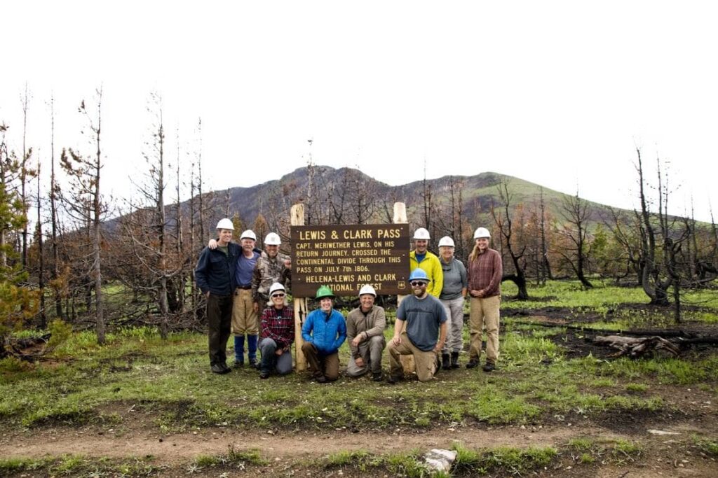
Lewis and Clark Pass via Alice Creek Trail
This scenic, family-friendly trail celebrates the rich pioneer and Native history of the area. This pass is where Merriweather Lewis crossed the Rocky Mountains on his return back east, and […] LEARN MORE
MacDonald Pass to Tenmile Creek via Switchback Ridge
From MacDonald Pass, follow the CDT south for about 3.2 miles as it meanders along the ridgeline until you reach the junction with the Switchback Ridge Trail (#348). Turn left […] LEARN MORE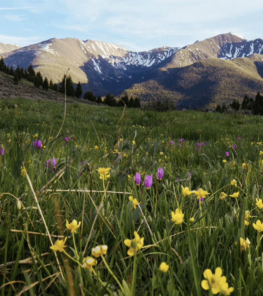
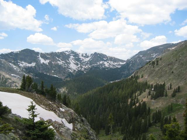
Limekiln Hill
The CDT going south from Pipestone Pass has a fairly gradual ascent the whole way until the last part, which is quite steep. The trail passes through pine forests with […] LEARN MORE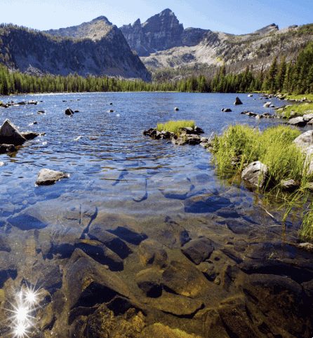
Warren Lake
This lake has multiple entrance options, but we suggest hiking from the West Fork Fish Trap Creek trailhead (FS trail 130). The incline is gradual for the first 7.5 miles, […] LEARN MORE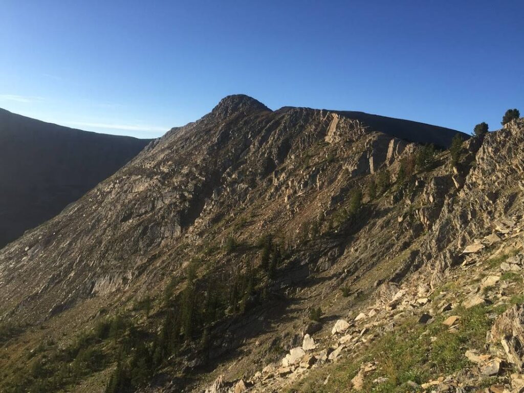
Upper Seymour Lake on the CDT
This well-maintained section of the CDT weaves through lodgepole pine forests to Upper Seymour Lake, a crystal-clear lake nestled in a striking cirque. The hike is not too challenging, with […] LEARN MORE
CDT from Chief Joseph Pass
Chief Joseph Pass, on the border of Idaho and Montana in the southern end of the Bitterroot Mountain Range, reaches 7,264 feet. Heading north on the CDT from Chief Joseph […] LEARN MORE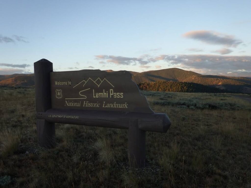
Lemhi Pass Towards Goldstone Pass
In 1805, the Lewis & Clark Expedition crossed the Continental Divide at Lemhi Pass. At the present-day National Historic Landmark, the CDT intersects with the Lewis & Clark National Historic […] LEARN MORE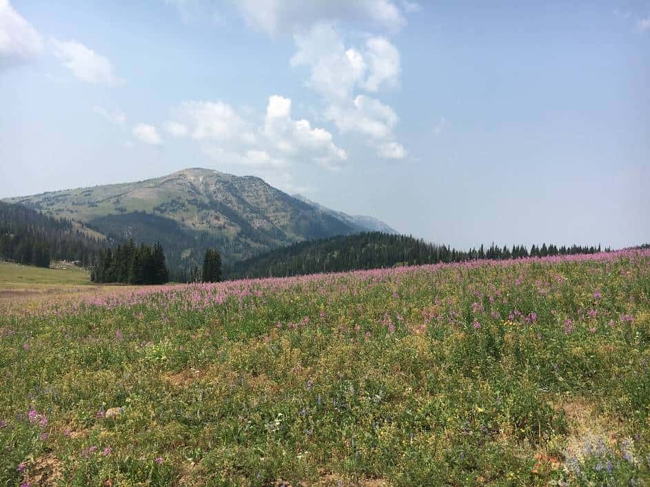
Centennial Mountains and Blair Lake
Enjoy spectacular views from the Continental Divide to the Island Park Caldera along the Montana-Idaho border, follow Hell Roaring Creek, where anglers can cast for trout on their way to […] LEARN MOREMinimize Your Impact
Want to learn how best to minimize your impact outdoors? When you follow the 7 Principles of Leave No Trace, you’ll help make sure the trail stays healthy for years to come.
Join Us At An Event
CDT communities host community events and hikes throughout the year.
CDT Map Set
Version 4.0 is here! Download the latest CDT map sets for the most current trail alignment, updated water sources, and more.
The Continental Divide Trail Coalition (CDTC) CDT Map Set covers the entirety of the official Continental Divide National Scenic Trail route at a scale of 1 inch = ½ mile. Each page includes topographic information, an elevation chart, water sources, and waypoint data. The maps are available for download as state or section bundles in three file types, serving hikers with a variety of navigation needs and trip lengths — from day hikes to thru-hikes.
New to the map sets? Check out our step-by-step tutorial on how to download free PDF section maps directly from the CDT Interactive Map.
While we work hard to provide the most comprehensive and up-to-date information in these maps, users are solely responsible for their own safety and planning while on the CDT. CDTC, the U.S. Forest Service, and any other parties are not responsible for errors, omissions, or inaccuracies in the maps or data. All information is subject to change. Please refer to multiple sources, including local land managers and the CDTC Closures & Alerts page, when preparing to travel on the CDT.
The CDT Map Set is a free public resource made possible by generous donations and support from the CDT community. If you find these maps useful, please consider making a donation to support their continued maintenance and production.
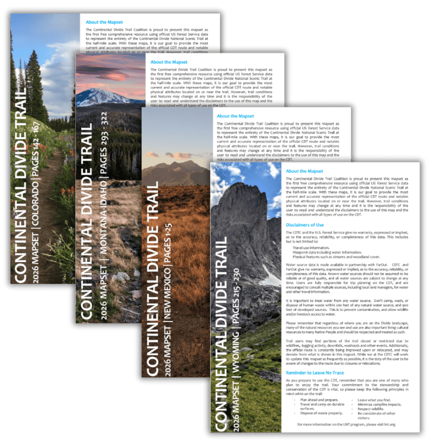 4th Edition
Updated CDT Map Sets — Free to Download
Our 4th edition map sets feature the most current CDT centerline data available, updated water sources, and new land ownership layers. Built in collaboration with the USFS and USGS at half-mile scale — available as complete state bundles or individual section maps.
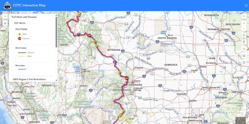
Interactive Map
Explore the full CDT route with toggleable data layers including water sources, closures, reroutes, Gateway Communities, and downloadable section maps.
Open the Map →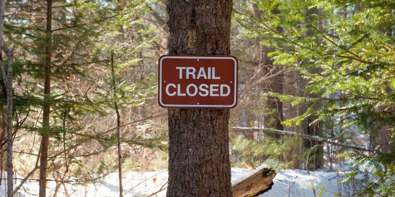
Closures & Alerts
Check current fire closures, reroutes, and trail alerts before you go. Updated regularly by our Trail Information team in coordination with land managers.
View Alerts →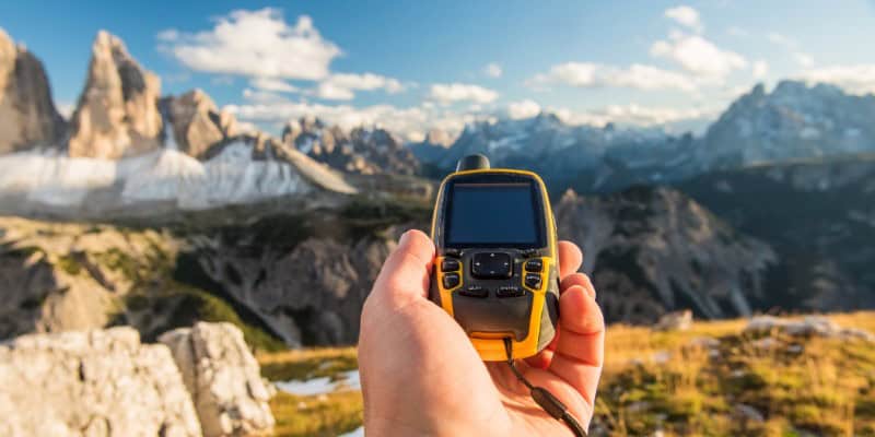
GPX & KMZ Data
Download official CDT route data in GPX and KMZ formats for use with Gaia GPS, Garmin devices, CalTopo, Google Earth, and other navigation tools.
Download Data →Safety
The CDT is a world-class destination for year-round recreation, enjoying it comes with the inherent risks of the backcountry. We want to remind all trail users that you are responsible for your own safety, and your knowledge and equipment are your own first line of defense in an emergency situation. In the case of an emergency on the Continental Divide Trail, always call 911 or a local emergency number before reporting the incident to CDTC.
Being prepared with knowledge, equipment, and planning can help mitigate many of the risks associated with hiking and camping along the CDT.
Always CALL 911 if possible during an emergency situation. If you do not have cell phone service, attempt to call 911 anyway; carriers outside of your phone plan are required to place emergency calls if they are available. A Spot device or another type of satellite messenger may also provide another communication option, although it does not guarantee your safety.
If you see something, say something. We’ve developed an incident report form that can be used to alert us of emergency situations after you’ve reported them to police, report all trail emergencies, incidents, suspicious activities, resource damage, or information on missing or suspicious persons on the Continental Divide Trail to local rangers or law enforcement officers as soon as possible, then use this form to report to and document with the Continental Divide Trail Coalition (CDTC). This form can be completed electronically and e-mailed as an attachment to [email protected], or printed, completed, and then mailed to: Incidents, CDTC, 710 10th St., Ste. 200, Golden, CO 80401.
We suggest the following general safety rules:
1. Leave an itinerary with a trusted person at home. For thruhikers, having a plan in place for your support person when you miss a check-in is important. However, please note that some areas along the CDT are very remote and may not have cellphone service, including common alternates to the official trail. Using satellite beacons or similar will have greater reliability of messaging, if you intend to check-in directly from trail.
2. Trust your intuition. If a particular place or a person gives you an off feeling, trust your gut and get out of the situation as soon as possible. It’s better to trust your judgment and stay safe.
3. Camp away from roads, and be aware that anywhere people congregate, like campgrounds, may have greater risk of human-based incidents.
Always CALL 911 if possible during an emergency situation. If you do not have cell phone service, attempt to call 911 anyway; carriers outside of your phone plan are required to place emergency calls if they are available.