The Continental Divide is the ridge of high ground — mostly along the crest of the Rocky Mountains — that decides which ocean a raindrop reaches. Water that falls west of the Divide drains toward the Pacific Ocean; water that falls east of it flows toward the Atlantic Ocean and the Gulf of Mexico. In the United States, the Divide runs through Montana, Idaho, Wyoming, Colorado, and New Mexico.
It’s one of the most important natural features in the Americas, and also one of the most misunderstood — people picture a single mountain or a line painted on a map, when it’s really a continent-spanning watershed boundary. At the Continental Divide Trail Coalition (CDTC), we work to complete, promote, and protect the Continental Divide National Scenic Trail (CDT), the 3,100-mile footpath that traces this very crest from Mexico to Canada. We spend our days on and along the Divide, so here’s the clearest, most complete answer we can give — what it is, where it runs, why it matters, and how you can go stand on it yourself.
Where is the Continental Divide?
The main Continental Divide of the Americas — also called the Great Divide — is the longest and most prominent watershed boundary on the continent. It begins near Cape Prince of Wales in western Alaska, runs down through the Canadian Rockies, crosses into the United States in northwestern Montana at Glacier National Park, and follows the spine of the Rockies south through Idaho, Wyoming, Colorado, and New Mexico before continuing into Mexico, along the Sierra Madre and the Andes, all the way to the southern tip of South America.
In the U.S., it threads through some of the wildest country we have: three national parks (Glacier, Yellowstone, and Rocky Mountain), more than 20 national forests, and Bureau of Land Management lands across five states. That’s the same corridor the CDT follows — you can see the full route on our trail maps and data.

How does the Continental Divide work?
A continental divide is an area of raised terrain that separates a continent’s river systems — the boundary that determines which way water flows after it hits the ground. Stand with one boot on each side of the Divide and you’re straddling two oceans’ worth of destiny: a snowflake that melts to your west may end up in the Pacific, while one that melts to your east can travel to the Gulf of Mexico and the Atlantic.
That single line feeds some of North America’s greatest rivers. West of the Divide, snowmelt gives rise to the Colorado and the Columbia. East of it, the headwaters of the Rio Grande and the Missouri–Mississippi system begin their long journey to the sea. Our friends at Yampatika put it beautifully in our explainer on where watersheds part: the Divide doesn’t just split water, it has quietly shaped where people settled, farmed, and built across the West.
Continental divides exist on every continent except Antarctica, which is too dry and frozen for water to drain toward the sea. North America actually has several divides — but when people say “the Continental Divide,” they mean this one, the Great Divide.
Why the Continental Divide matters
The Continental Divide is a well known geographic feature and plays several important roles worth mentioning and understanding.
It's the source of the West's water
The Divide is, in a real sense, the faucet for the American West. The snow that piles up along its crest each winter becomes the spring runoff that millions of people, farms, and ecosystems depend on which is exactly why questions of who gets that water, like the long-running negotiations over the Colorado River, are so consequential.
Here’s a paradox we know firsthand: the place that defines where America’s water flows is also one of the hardest places to find water. In our own assessment of the trail, CDTC documented six stretches in New Mexico where hikers travel between 22 and 49 miles without a reliable water source. It’s a vivid reminder that the Divide gives water to the continent long before it’s convenient to the traveler.
It's the Spine of the Continent
The Divide isn’t only a water boundary — it’s a wildlife highway. This nearly unbroken corridor of high country, often called the Spine of the Continent, lets elk, pronghorn, grizzly bears, and wolverines move and migrate across vast distances, connecting habitats from Yellowstone toward Yukon. Protecting that connectivity is part of why we work to keep the trail and the lands around it intact (it’s also why we ask hikers to share the trail responsibly with bears).
As the conservationist Aldo Leopold wrote, “A thing is right when it tends to preserve the integrity, stability, and beauty of the biotic community.” The Divide is one of the best places in North America to see that idea in action.
It connects people and cultures
Long before it was a line on any government map, the Divide was — and is — home. The high country of the Divide lies within the ancestral and present-day homelands of many Tribal Nations, including the Blackfeet Nation, the Nuu-agha-tuvu-pu (Ute), the Diné (Navajo), Apache peoples, the Pueblos, and the Shoshone, among others.
The Blackfeet have described the Divide as the “backbone of the world” — a phrase that captures its scale and significance far better than “watershed boundary” ever could. CDTC works in partnership with Tribal Nations and communities along the trail, and we encourage readers to learn the history of the specific lands they visit.
7 remarkable facts about the Continental Divide
- Its high point tops 14,000 feet. The highest point on the Continental Divide is Colorado’s Grays Peak, at 14,278 feet.
- One peak sends water to three seas. At Triple Divide Peak in Glacier National Park, precipitation can flow toward the Pacific, the Atlantic (via the Gulf of Mexico), and Hudson Bay.
- There is a creek that flows to two oceans at once. At Two Ocean Creek in Wyoming, a single stream splits, sending water to both the Atlantic and the Pacific.
- Sometimes the water goes nowhere. Around Wyoming’s Great Divide Basin, the Divide splits in two and water that falls inside drains to neither ocean.
- It has many names. The Continental Divide is also called the Great Divide and the Western Divide.
- A trail follows it for 3,100 miles. The Continental Divide National Scenic Trail traces the Divide from Mexico to Canada and is one of the three legs of the “Triple Crown” of long-distance hiking.
- Congress protected a 50-mile-wide corridor for it. When the CDT was designated in 1978, lawmakers set aside a corridor 50 miles wide on either side of the Divide to route the trail.

How was the Continental Divide formed?
The Rockies that carry the Divide have a famously strange origin. Most big mountain ranges rise at the edges of colliding tectonic plates, but the Rockies stand in the middle of the continent, far from any plate boundary. The leading explanation is that, roughly 70 million years ago, a slab of ocean crust slid beneath North America at an unusually shallow angle, buckling the crust far inland and lifting the mountains we walk today. We tell the full story in our deep dive on the geologic history of the Continental Divide.
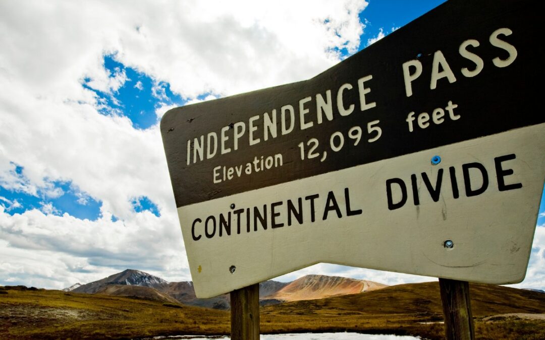
Where can you see the Continental Divide?
You do not have to thru-hike to stand on the Divide. Some of the most accessible spots are mountain passes where a highway crosses the crest:
- Wolf Creek Pass, Colorado. A drive-up trailhead sits right at the top of the Divide on U.S. Highway 160, about 23 miles east of the Gateway Community of Pagosa Springs, with sweeping views of the San Juan Mountains.
- Camp Hale–Continental Divide National Monument, Colorado. Designated in 2022, this 53,804-acre monument along the Divide is where the U.S. Army’s 10th Mountain Division trained for World War II — and where those veterans went on to help launch the country’s ski industry. The land is also revered by the Nuu-agha-tuvu-pu (Ute) people, and the CDT runs through it for about 20 miles. CDTC was proud to support its protection.
- Glacier, Yellowstone, and Rocky Mountain National Parks. Each offers easy, signed places to see and cross the Divide.
When you are ready to go a little farther, our Gateway Communities — trail towns like Pagosa Springs, Chama, Grand Lake, and Lincoln — make great basecamps, and our day and section hike guides can point you to a stretch that fits your time and ability.
Walk the Divide yourself
The best way to understand the Continental Divide is to stand on it. The Continental Divide National Scenic Trail is the highest, wildest, and most remote of America’s 11 National Scenic Trails, climbing from 4,000 to over 14,000 feet and preserving nearly 2,000 natural, cultural, and historical treasures along the way. More than 200 hikers attempt the full thru-hike each year, but you can experience the Divide in an afternoon.
Start with our Explore the Trail hub, plan a trip with our maps and data, or — if the Divide has you dreaming bigger — read up on thru-hiking the CDT. And if you love this landscape, the most powerful thing you can do is help protect it: become a member or donate to keep the Continental Divide wild for the next generation.
Frequently asked questions
What is the Continental Divide in simple terms?
Where does the Continental Divide start and end?
Is the Continental Divide in Colorado?
Why is the Continental Divide important?
How long is the Continental Divide Trail, and can you hike it?
The CDT runs about 3,100 miles from Mexico to Canada, and yes — you can hike all of it or just a few miles. See our guides to thru-hiking and day hikes to start planning.
Sources & further reading: National Geographic Education · Continental Divide of the Americas (Wikipedia) · Encyclopædia Britannica · National Park Service — Glacier
Keep exploring the Divide with us
If this sparked something, come along for the journey. The Trail Log is our free newsletter — true stories from the trail, news from along the Continental Divide, and simple ways to help protect it, delivered straight to your inbox.